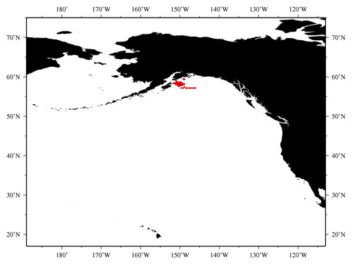
|

* The stations below are sorted by date, then by time, and then by "Orig-Identifier". As time over-rides the Orig-Identifier sequencing,
missing or incorrect times may create incorrect "Orig-Identifier" and/or station sorting.
* * B= Total Biomass, Z = Zooplankton, P = Phytoplankton
| YYYY-MM-DD* | Time (GMT)* | Longitude | Latitude | Station (Orig-Identifier*) | Station (Parameter List**) |
|---|---|---|---|---|---|
| 2004-07-09 | 01.62 | -149.0175 | 59.3087 | B-- | |
| 2004-07-10 | 22.48 | -146.0360 | 57.2402 | B-- | |
| 2004-07-11 | 03.65 | -146.3972 | 57.2052 | B-- | |
| 2004-07-11 | 10.58 | -146.9583 | 57.2225 | B-- | |
| 2004-07-11 | 15.52 | -147.3235 | 57.2323 | B-- | |
| 2004-07-11 | 20.70 | -147.7233 | 57.2333 | B-- | |
| 2004-07-12 | 01.23 | -148.1072 | 57.2307 | B-- | |
| 2004-07-12 | 05.93 | -148.4703 | 57.2353 | B-- | |
| 2004-07-12 | 10.43 | -148.8458 | 57.2555 | B-- | |
| 2004-07-12 | 15.33 | -149.2388 | 57.2472 | B-- | |
| 2004-07-12 | 20.17 | -149.6470 | 57.2433 | B-- | |
| 2004-07-13 | 02.22 | -150.2688 | 57.6832 | B-- | |
| 2004-07-13 | 04.63 | -150.0823 | 57.8352 | B-- | |
| 2004-07-13 | 07.17 | -149.9267 | 57.9773 | B-- | |
| 2004-07-13 | 09.50 | -149.7282 | 58.1223 | B-- | |
| 2004-07-13 | 11.50 | -149.6072 | 58.2205 | B-- | |
| 2004-07-13 | 13.57 | -149.4525 | 58.3637 | B-- | |
| 2004-07-13 | 15.30 | -149.6872 | 58.4462 | B-- | |
| 2004-07-13 | 16.77 | -149.7952 | 58.5433 | B-- | |
| 2004-07-13 | 18.08 | -149.8688 | 58.4260 | B-- | |
| 2004-07-13 | 19.75 | -149.9420 | 58.2845 | B-- | |
| 2004-07-13 | 21.32 | -149.9877 | 58.1673 | B-- | |
| 2004-07-13 | 23.28 | -150.0470 | 58.0677 | B-- | |
| 2004-07-14 | 01.73 | -150.1293 | 57.9060 | B-- | |
| 2004-07-14 | 04.32 | -150.4675 | 57.8027 | B-- | |
| 2004-07-14 | 05.93 | -150.4110 | 57.9135 | B-- | |
| 2004-07-14 | 08.00 | -150.3600 | 58.0893 | B-- | |
| 2004-07-14 | 09.90 | -150.3123 | 58.1895 | B-- | |
| 2004-07-14 | 11.60 | -150.2657 | 58.2970 | B-- | |
| 2004-07-14 | 13.57 | -150.2253 | 58.3983 | B-- | |
| 2004-07-14 | 15.37 | -150.1430 | 58.5308 | B-- | |
| 2004-07-14 | 17.20 | -150.1000 | 58.7038 | B-- | |
| 2004-07-14 | 19.50 | -150.5123 | 58.6532 | B-- | |
| 2004-07-14 | 21.43 | -150.5497 | 58.5490 | B-- | |
| 2004-07-14 | 23.15 | -150.5575 | 58.4757 | B-- | |
| 2004-07-15 | 00.90 | -150.5833 | 58.3307 | B-- | |
| 2004-07-15 | 02.43 | -150.6307 | 58.1873 | B-- | |
| 2004-07-15 | 04.17 | -150.6790 | 58.0753 | B-- | |
| 2004-07-15 | 05.90 | -150.6917 | 57.9470 | B-- | |
| 2004-07-15 | 07.62 | -150.7407 | 57.8145 | B-- | |
| 2004-07-15 | 10.55 | -151.0172 | 58.1182 | B-- | |
| 2004-07-15 | 12.37 | -150.9840 | 58.2468 | B-- | |
| 2004-07-15 | 14.42 | -150.9692 | 58.3592 | B-- | |
| 2004-07-15 | 15.83 | -150.9503 | 58.4792 | B-- | |
| 2004-07-15 | 17.75 | -150.9173 | 58.6270 | B-- | |
| 2004-07-16 | 11.33 | -149.0565 | 58.0992 | B-- | |
| 2004-07-16 | 13.35 | -149.2778 | 58.0110 | B-- | |
| 2004-07-16 | 15.27 | -149.4738 | 57.9400 | B-- | |
| 2004-07-16 | 16.48 | -149.5885 | 57.9145 | B-- | |
| 2004-07-16 | 18.40 | -149.7848 | 57.8455 | B-- | |
| 2004-07-16 | 20.80 | -150.0025 | 57.8163 | B-- | |
| 2004-07-16 | 22.70 | -150.2357 | 57.6993 | B-- | |
| 2004-07-17 | 18.67 | -148.7870 | 58.0368 | B-- | |
| 2004-07-18 | 09.25 | -151.3355 | 58.4450 | B-- | |
| 2004-07-18 | 11.18 | -151.7223 | 58.4202 | B-- | |
| 2004-07-18 | 14.10 | -151.1377 | 58.4537 | B-- | |
| 2004-07-18 | 19.28 | -150.8800 | 58.8245 | B-- | |
| 2004-07-18 | 21.27 | -150.8803 | 58.9658 | B-- | |
| 2004-07-18 | 23.38 | -151.0148 | 59.1632 | B-- | |
| 2004-07-19 | 11.78 | -148.9815 | 59.3073 | B-- |
| Sub-Collection: EcoFOCI |
COPEPOD Web v10.1 [ 2010-Dec ] |
